Thursday, July 1, 2021

Early Summer Part 3: US-27, again

Dan Faces the Big South Fork, TLDR:

60 miles from US-27 trailhead near Whitley City, KY to Bandy Creek Campground in TN from May 30th to June 2nd

Beings spotted: Hordes of red spotted newts, daddy longlegs, abundant flies, skinks, little snake, day hikers, backpackers, families, dogs, snails, centipedes

IAfter being home for a week I decided to restart my hike at about mile 232 of the sheltowee, near Flat Rock Missionary Baptist Church. Over a year ago my first ever backpacking trip had ended here, after I'd explored the hills around London, passed Cumberland Falls, and the many old mines by the Trace.

The trail here wound behind a string of homes by the Church. A family was at play in their backyard. Partitioned by a wall of trees, I don't think they noticed me hiking by. I passed by a homestead crawling with chickens, then made my way through the church's property, then crossed US-27 to begin my hike into the woods proper. 

Here the trees were thin and new, and the woods were crisscrossed by ATV tracks, and littered with beercans and tires of yeeyee boys past. I crossed a thin gravel road, a sign civilization was giving way to the wild. And now I was descending to the valley of the Cumberland River, and the trees shot up taller and bore many more rings, and the undergrowth bloomed thicker, cutting at my bare legs. It was clear few hiked this trail. 

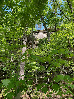
The wilderness grew more evident--the first rock wall I saw going down to the Cumberland. 

I understood this rock shelter as a "gateway" into the wilderness of the Big South Fork--foreshadowing the great walls of rock and waterfalls to be found deeper in the park. Long ago Cherokee American Indians among other tribes lost to history called these natural recesses their homes. 


A small, seasonal stream of water trickled from the roof of the shelter. Trees competed with the rock, curving up to reach the sun. Great boulders sat in this pocket of earth, perhaps as tall as 4 or 5 grown men. This stretch of trail featured worn stone steps to help navigate the dips and rising of the earth.

You emerge from the shade of the inaugural rock shelter and walk alongside towering rock walls, weathered with a gap snaking along the base.

Walking beneath walls undulating, as a result of some drawn out process of nature.

Critter watch!


Finally I descended to the first creek of the hike. The stones poking out of the creek, the serenity, the greenery enveloping the stream--it all reminded me of the rocky creeks and streams I'd seen in the  Smoky Mountains.

All I could hear was the babble of a creek. It was peaceful. 

The sides of the trail were thick with ferns of all kinds, blanketing the slopes up to where rock walls erupted up along the trail. On the right, my first view of the cumberland river. it was still and turbid-looking here. 

I didn't see a single other person until I got up to my campsite at the end of the day. A lonely trail winding along the banks of the cumberland river, flanked on my left by high rock cliffs.

Seasonal waterfalls cascaded down to the river.

Water spills with abandon over slippery rocks down to the Big South Fork, waterfalls dance on their course to the river.

It was late in the afternoon now and I was headed for Alum Ford Campground, a small primitive camping area along the river, just past Yahoo Falls. 


At Alum Ford that night I met a couple of fellow backpackers, and another handful of people in 4wd vehicles--the road up to the campground was rough, washed out gravel. The campground had only 8 spots, and a newer looking privy in the middle. I strung up my hennessy hammock kinda awkwardly as there was a dearth of good trees to hang from at my spot. There was a little footrail going down the steep bank to the ford, which was placid and quiet at sunset.


I camped next to a stream that trickled water all night. This melded with the calls of whippoorwills, and animal screams, and boat engines in the distance, a cacophony that engulfed me in my sleep. The next morning held out for me a blue sky, and sunlight shining through gaps in the canopy of the woods.

As I ate breakfast and packed up, a few parties of backpackers passed through the camp, which the Sheltowee ran directly through. One was a couple whom I envied and one was a man with his dog, the smaller of which roved with a little pack of its own on its back. 

Pockmarked, moss-graced boulder bathed in sunlight

A sunlit trail on monday


Great mossy boulders by the edge of cotton patch creek.


Sunlight illuminating the waters of the Cumberland, tall grasses ruffled by the wind. A sweet smell of wildflowers wafts in the early summer air. 

Monday night I made it to Rock Creek, camping at Great Meadows Campground. Though the campground was free, it was unfortunately littered with food and trash from campers of days past. The only other family camping in the same loop as I was shut their generator off at nightfall. I was left in the dark with just the din of flowing Rock Creek to color my dreams. 
Six miles after leaving Alum Ford campground stood the bridge over the cumberlands at Yamacraw. 


The forest floors always looks enchanting dappled with warm sunlight.

From US-27 to Great Meadows campground was about 33 miles. The next post I'll cover the final leg of my early summer backpacking travels: Getting from Rock Creek to Bandy Creek Campground. 


Saturday, May 29, 2021

Mountain Laurels in the Sun (Early Summer Pt 2)

I left off on the last post talking about settling onto the banks of Cave Run Lake on the night of the 19th, having made it approximately... 38 miles?

The hills down to the lake absolutely wrecked me, so I had a late morning at Cave Run Lake, not leaving my campsite til after 10. I spent the early hours of the day bushwhacking to the water's edge, and the shore up to it had a long drop of stacks of shale to climb down. I collected some questionable water (times like these make me grateful that I was introduced to the sawyer water filter) and smacked on a traditional breakfast of 3 packets of cinnamon apple instant oats.


The view after bushwhacking down to the shore of Cave Run Lake.

I was headed towards Clear Creek Lake for the rest of the day, continuing to snake along the shore of Cave Run Lake before climbing up to the ridges of Pioneer Weapons Area. My topographic map had this area labeled as "cedar cliffs". This was another section where water was hard to come by, there was none between leaving Cave Run and getting to Clear Creek Lake. 
You can very vaguely spot Cave Run Lake in the distance from the ridges of pioneer weapons WMA. Another hot early summer day on trail.

I camped that night at Clear Creek Campground, a place I hope to return to with the people I love. Birds sang all night, the water I drew from the creek was cool and crisp. I saw a little black cat. The campground caretaker offered me coffee to start my day out with the next morning, which I happily accepted. 

The morning was bright and I saw a little cat standing right by the gate of the campground. Right at 8:30 the caretaker pulled up in his truck next to my site, pulled out a stoneware carafe of coffee from the back, and let me pour a mug for myself. Talking to him and havin some caffeine before my hike really set a positive tone for the day, where I had a huge task at hand--I planned to hike 18 miles from Clear Creek to Corner Ridge trailhead. 

Mountain laurels in the sun, and a blaze in Menifee County.


This is probably my favorite section of trail in this first portion of the trace that I hiked. You travel along a ridge on the border of Menifee and Bath county, and get to gaze out at miles of forested hills, lush with life and bright in the sun, with rocky balds and spots of clay that are reminiscent of RRG, down the road.

Looking out to KY 1274 (Old Beaver Rd), the first paved road since leaving the Clear Creek Lake area.

After hiking the scenic ridges after Clear Creek Lake, you follow a set of ATV trails up to Old Beaver Rd. Along the way I got passed by a 9-unit caravan of land cruisers, twice. I stood off to the side and waved hello, and then hello again to each one that passed, admiring all their bumper stickers as each land cruiser rumbled away. Once you hit the pavement it's a 3-mile roadwalk up to where Clifton Rd turns into rough ATV track.


Back in the woods for another mile and a half, trailing Clifton Creek, which had a number of little cascades. You travel upwards, legs burning as you leave the valley with the creek. There's a large rockshelter with a little waterfall near the end of this section.


The sunlight dissipated as it filtered through the canopy down to play on the surface of the creek. 

ATV road turns back into pavement, you turn right onto Kendrick Ridge Rd, and push on for another 5 mile roadwalk. It was about 4 or 5 when I got to this point, and the sun still blazed mercilessly overhead as I trod along the highway, cars passing me sporadically. It was a sunny afternoon outside of Frenchburg and every gentle breeze put a smile on my face. This was a taste of a different kind of scenery from the density of leaves and bark you encounter in the woods--to your left and right you see wide open fields and farmland. Eventually, you pass Tarr Ridge Union Church, where I stopped to make dinner and refill my supplies of drinking water from a garden hose. 

Soon after leaving the church, the trail turns onto (still paved) Corner Ridge road, but only for a little over a mile more. I passed horse farms, families enjoying the dregs of the day, and many barns on this stretch. And then I made it to Corner Ridge Trailhead: the entrance to Red River Gorge along the Sheltowee Trace. I was now 65 miles away from where I'd started 4 days ago with Martin. By 8 pm I had my tent set up, bear bag hung, and was settling in for a night in the gorge at a campsite I found near the trailhead.

The next morning I got up early and began the descent into the gorge. I envisioned, in the map of my mind, corner ridge as a long forested hallway or corridor that spits you out into the heart of the gorge. It winds along this ridge, slowly getting more and more rugged as you come down to meet Gladie Branch.

One of the first waterways I encountered Saturday morning in the gorge.

First sightings of rock faces in the gorge!

At the end of my hiking on this 6th day, last Saturday, I'd made it to the suspension bridge in the gorge, near jump rock. Approximately 78 miles for this trip, including the new reroutes along Cave Run Lake. I ended up going home this day because I realized I lost my SPOT gps beacon, and I didn't feel safe continuing on without it. 

I have the usual feelings of inadequacy about cutting this trip short, like I never really accomplish anything I ever set out to do. Or like I don't actually possess the will or drive to actually ever complete a thru-hike. Ultimately nothing matters tho, we're just flesh bags on a big rock, my standards for my self are too high anyways, whatever. Soon I'll be going back out there to sup more of the contours of the earth, as much as I can before my leave at work runs out.

Edit 9/18/21 
I am sitting outside willy T library on a Friday night in the middle of September. My classmates are chasing fountains of youth somewhere on the streets and in solo cups and I'm re-reading these posts, living through them, feeling tears welling as I'm trying to feel again the dappled sunlight in my mind's eye. 

I'm thinking about when I was 18, and I lived off Alumni, and I barely loved myself enough to pry my eyes open to the desperation and delusion of my living situation, and I hiked those lonely ridges straddling Menifee County for the first time. How I was carving out a shelter for my aching heart to rest. How I miss backpacking so much. How I should go to sleep. How bumbling with wild earth under my boots makes up nearly all of my dreams.

Good days, I've been on my empty mind shit.


Thursday, May 27, 2021

Early Summer Part 1

I was on the Sheltowee beginning May 17th up until yesterday, May 22nd. I got about 78 miles in and made it from Morehead, the northern terminus, down to the suspension bridge in RRG.

My friend Martin and I started at the northern trailhead, where yellow primroses dotted the grass.
 

We crossed a few streams that seemed to signal that at least we'd find some reliable sources of water along the way. And then made our first climb up onto the ridgeline that we'd be following all day. 


Martin brought his binoculars and saw a bird he'd never spotted before--a scarlet tanager. Our afternoon was spent in a wooded landscape, paralleling a gravel road for a bit. Once in a while the canopy would open up a little to the side and you could spot the hills of Eastern Kentucky in the distance. That first day we made 10 miles and camped at Clark Park, where the resident dog could be heard genially sniffing outside our tent as we tried to catch some shut-eye.

The next day I got up a bit late, maybe 9, tired from our first day of roaming Kentucky's hills. We began our day's hike at maybe 10 in the morning, and climbed away from the holler of Dry Branch, up onto a ridge bare but for grass that was home to a cow pasture. We re-entered the woods and emerged at Holly Fork Rd, where we filled up our reserves of water just before the suspension bridge. I knew from experience that this was the last reliable source of water along the Sheltowee Trace until Eagle Lake on Morehead State University's campus, about 12 miles south. 

the pasture was full of fresh cowpats.


You follow a forest floor, full of tiny streams and small wildlife, (I saw an Eastern Box Turtle, mascot of the trail for the first time!) then climb back up to a forest road that takes you up to cross a bridge over I-64. After you cross over the interstate, it's a right onto a gravel road (Forest Road 977) that you will follow for about 8 or 9 miles, basically until you reach Morehead. Martin and I took a break a couple miles into 977 where he realized he had developed awful blisters, and at this point decided to cut his trip short and get our sweet pal Ethan to take him back home to Lexington.

The walk along 977 developed a monotony once I was alone, broken a couple times by views of Eastern Kentucky hills, lit by the hues of the setting sun.


I was cutting it close with daylight, and as I flew towards Morehead it grew darker and darker.


The hills near Morehead are challenging and by the time I was nearing Eagle Lake at MSU I felt like every step was an explosion of pain in my feet. I was dragging my carcass from the hills onto this college campus after dark, trying to find the least sus place to put my tent up for the night. 

The next day kicked my ass too. The dawn of the third day found me eating 4 mini vanilla moon pies for breakfast, washed down by a jumbo helping of chocolate nesquick. I made my way from Morehead's Allen IGA to Clearfield, on the outskirts of town, where I saw a little black cat scurry across a trailer park as recess was in full force at the elementary school across the road. The laughter and joy of the kids filled the bright early summer air, and I recalled the feeling of anticipation as the number of coming schooldays wasted away and the brightness of summer break called out to all of us. This year I finished my first full-time semester at college and just felt dazed. But the sounds of children playing fell away and I was walking further away from the city sprawl, deeper into a farming holler, an idyllic landscape dotted with cows, the earth tilled and fertile here, and after several miles on pavement from Eagle Lake the ST turned right, up and away into the hills once again. To Cave Run Lake I was bound. 
It was hot; the winding hills up to the lake made for a hard hike. On the left shadows fill the trail and on the right, high rock precipices (amburgy rocks?). This section of the trail is home to Limestone Knob, the highest point in Rowan County.
There was also no water to be found along the trail from Morehead to Cave Run Lake, about an 8-mile stretch. Last May when I hiked this section there was a natural spring near Limestone Knob right on the forest road, but when I came up to it this year it was dry.

When I got to the lake, I had to walk down the boat access road at High Bank picnic area to get to the shore, where I collected water amongst floating pieces of litter, infused by motor oil from the boats that sped around the lake. I sat on the shore for a while bleaching in the sun as I soaked my aching feet.

After a really late lunch at High Bank picnic area, I set off to cross the dam. On my left the lake was splayed out, framed by the hills I'd traversed earlier that day, and to my right was the spillway and a park, where families gathered against a background of trees and mountains.

    I turned into Stoney Cove Recreation Area, where more families were celebrating with potlucks and picnics, and headed towards the woods, turning onto the Caney Trail. Here the Sheltowee Trace has been rerouted to trail the shores of Cave Run Lake. This was also a shared-use trail with horses, and though horse season had just started a couple days before I hiked it, the terrain was destroyed and pocked by deep hoofprints in muddy areas. I hiked during a dry spell, but I could see this trail as being miserable in or right after the rain. 
    I was fighting the setting sun, racing towards the place I would make camp as the world grew dimmer and the light began leaking out of the woods. I settled in for the night along Cave Run Lake, and as the woods grew darker the soundscape of merriment and motors was replaced by the din of crickets chirping and whippoorwills calling into the night.

Morning along Cave Run Lake. Peep my Rakaia 2-person tent, super roomie when it's just me.